About us – Services
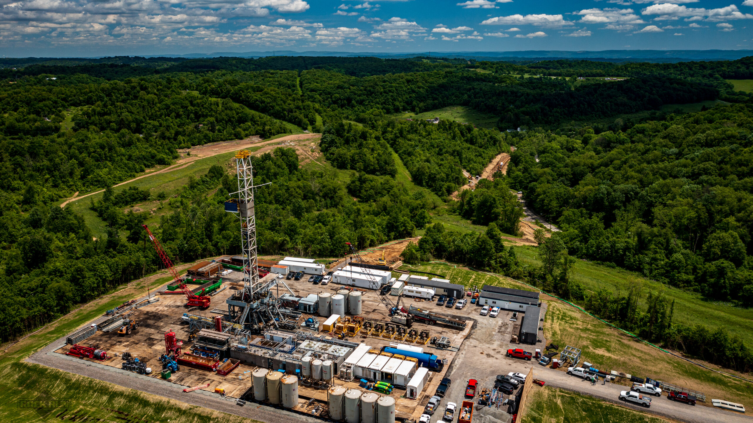
Our focus is providing a wide range of services to Appalachian Basin oil and gas with over 60 years of combined experience. We also provide services to construction, industrial, commercial, agricultural, and private clients.
Our consulting services consist of:
- Total Project Coordination and Job Site Supervision – Ability to see project through from paper concept to putting gas through the meter.
- Regulatory Compliance Oversight – The regulatory landscape is always evolving and we can help you stay on top of the big issues. We also keep track of the small details that can get lost in the shuffle.
- Environmentally Sensitive Issues – Rock Run will coordinate with the relevant agency to clear any environmental or cultural hurdles during your permitting process.
- Road Bonding and Maintenance Plans – Rock Run can process your road bond and develop your maintenance plan for state or local authorities. We perform pre-development planning assessments with our mapping capabilities and record the route with high definition video.
Keep up to date with our latest service offerings. News and Updates
Rock Run Enterprises, LLC provides a full line of drone or sUAS services.
Choosing a licensed pilot for private and commercial projects ensures clients receive professional service in compliance with all local and federal regulations.
Using the latest technologies, Rock Run has the ability to photograph, film, and map any project you present. We are fully insured and process all of our data in house to ensure quality control and privacy.
Our drone services consist of:
- Utility Line and Right of Way Inspections – Inspect your utility infrastructure before, during, and after construction. Check status of materials and vegetation.
- 3D Modelling – With our imagery processing, we can create a high resolution 3D model for analysis, planning, or promotional purposes.
- 4K Ultra HD Video – We use high end cameras and post production software to provide broadcast quality video in a deliverable file type and format of your choosing ie. hard copy, YouTube, hosted, etc.
- As Built Survey – We can fly your job site post construction and provide as built survey files in various CAD file formats such as DWG, DXF, FBX, LAS, OBJ. Coupled with our mapping capabilities, we can provide elevation contours in any interval you may need.
- Marketing Video and Photo – If you are a real estate agent or broker, we can provide you with updated and unique photos and video for your marketing campaign.
- Agricultural Monitoring – Farmers can use our imagery and mapping capabilities to better manage their fields. NDVI analysis can help spot areas in need of more irrigation or nutrients. High resolution photos can spot trouble areas invaded by pests. Mapping your acreage watershed can help improve planting layouts.
- Golf Courses – If you own or operate a golf course, we can provide ultra clear presentation quality photos. We can print up to 42″ wide for display in your facility. Let us map your course for tournaments and outings or other special occasions.
Rock Run Enterprises, LLC uses cutting edge technology for GIS Mapping services.
We have been using ESRI’s ArcGIS mapping software since 2001 and have kept up to date with the latest techniques, software updates, and capabilities.
Rock Run can map any type of project or infrastructure asset. We specialize in small local projects or a large scale multi-state operation.
Our mapping services consist of:
- Site Analysis and Feasibility Studies – We can use logistical and topographical analysis to help plan a project.
- Infrastructure Mapping – Rock Run can map your utilities such as water lines, parcel data, network, etc. Rapid updates make sure you have the latest available data.
- Real-Time Remote Monitoring – We can set up an operations dashboard for real-time monitoring. This gives you the ability to monitor assets in real-time from wherever you have a network connection on any device.
- On-line Map Hosting – Rock Run provides on-line web hosting for your mapping projects.
- Field Data Collection – We use survey-grade accurate GPS from EOS Positioning Systems with RTK. If you have a backlog of unmapped assets and need them located, we can do it. Integration of our collection techniques and web services let you monitor acquisitions in real-time.
Rock Run Enterprises, LLC provides water management services for a variety of clients.
Whether you are in oil and gas or simply need some swimming pool water, Rock Run has a solution for you.
Our Water Management services consist of:
- Water Management Plans – Whether you need an addition to your existing WMP or need to permit a new withdrawal site, we can get it done.
- Water Access and Marketing – Rock Run owns and operates several permitted bulk water sites. We can provide access to our water sites or market yours. We encourage shared use relationships to streamline service.
- Source Locating and Disposal Management – We can help if you simply need a compliant source of water or need a start to finish solution. Our working relationships with disposal service providers allows our clients quick and preferred access to your last minute disposal needs.
- Water Transfer and Storage – Locate and develop water transfer routes for continuous use and locate and maximize storage locations.
Rock Run Enterprises, LLC provides transportation services.
While Rock Run caters to the oil and gas industry, we also have our own interstate operating authority for general freight. Rock Run Enterprises, LLC does not provide freight brokerage or forwarding services.
Our transportation services consist of:
- Bulk Water Hauling – Rock Run operates vacuum tanker trucks for bulk water hauling.
- Trucking Coordination and Logistics – We have good working relationships with many reputable trucking providers. Whether you need a drilling rig moved or a dry van load, we can send you the right truck for the job.
Rock Run Enterprises, LLC provides environmental monitoring services.
Whether there are specific permit conditions or you want to be proactive in gaining background data about a specific site or region, we have a solution for you.
Our environmental monitoring services consist of:
- 24/7 Realtime access – Our monitoring stations all stream data 24 hours a day and automatically backup and archive results for instantaneous viewing.
- Monitor any Parameter – We can customize a station to monitor any environmental parameter such as various weather conditions like wind-rain-humidity-temperature-etc.
- The stations can monitor air quality such as VOCs like methane.
- Ambient light may be a concern if you are operating in a populated area.
- Stream live sound decibel levels before, during, and after specific operations for mitigation programs.